 Lauterbrunnen City Guide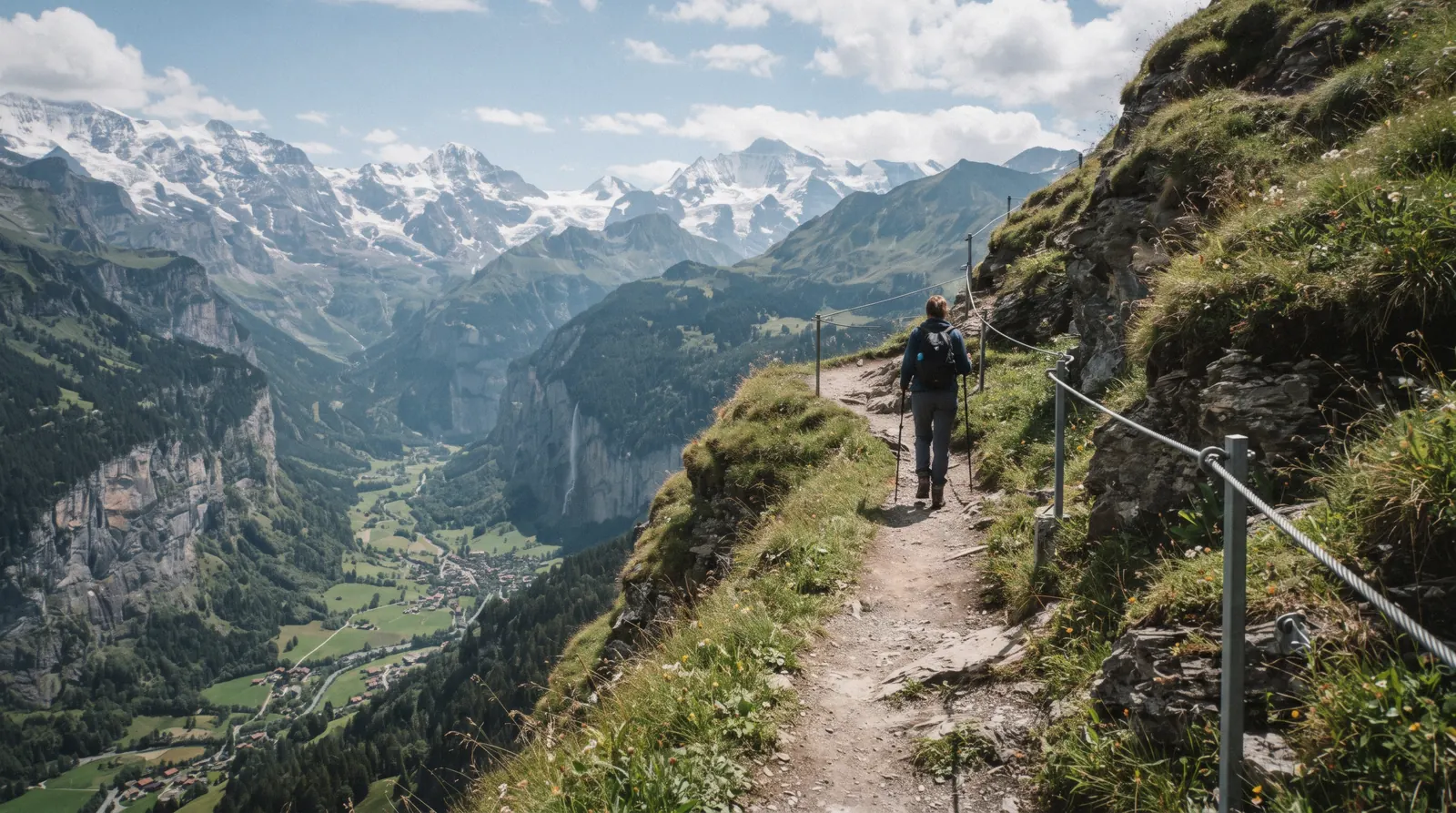
Lauterbrunnen Hikes: Every Named Trail, Numbered To One Map
A lauterbrunnen hike can mean a flat walk along the valley floor, a cliff-hugging via ferrata above Mürren, or a slow climb to a mountain lake inside a World Heritage Site. This page groups every named trail we cover, states honestly which ones have no official published length, and links out to the detailed guides. If you want to pair a walk with the falls, start with our Lauterbrunnen waterfalls guide, and if you need transport or lift fares first, our getting around Lauterbrunnen page has the routes. For the rest of the trip, see the Lauterbrunnen Switzerland guide.
Quick answer The short version on Lauterbrunnen hikes
The easiest lauterbrunnen hike is the flat valley floor walk from Lauterbrunnen to Stechelberg, which is free and has no official published length. The Mürren-Gimmelwald via ferrata is free to use, about 2.2 km long with roughly 400 m of height, and open 1 June to 31 October, with a minimum height of 1.50 m and a weight range of 40 to 100 kg. The Sulwald-Lobhornhütte trail from the Isenfluh cable car takes 2 hours over 4.8 km, and that cable car costs US$12.15 (CHF 10.00) single.
Key takeaways
- All the trails listed here are free to walk. Only the Isenfluh-Sulwald cable car, at US$12.15 (CHF 10.00) single, and via ferrata gear rental cost money.
- Several trails have no official published length. We say so rather than guess.
- The via ferrata runs 1 June to 31 October only. The Isenfluh-Sulwald cable car closes for a few days each autumn and spring for maintenance.
- This site does not rank trails. The numbered list is a map key, not a league table.
Every Named Trail, Grouped And Numbered To The Map
The facts below come from the operators and tourism bodies themselves. Where no official length or walking time has been published for a route, we say so instead of inventing a number. Each entry links to the detailed guide for that trail, area or village.
The Valley Floor
-
Valley Floor Walk, Lauterbrunnen To Stechelberg
Flat valley path FreeNot officially stated
This is the walk most people mean when they say a lauterbrunnen hike, and it is the simplest. The path runs flat along the valley floor from Lauterbrunnen village toward Stechelberg, under cliffs on both sides, with no lift and no ticket involved at any point. No official total length or walking time has been published for the route, so we do not quote one. What is known is that the turnoff for the Trümmelbach Falls sits about 3 km from Lauterbrunnen station, which makes the falls a natural half-way decision point on the walk. From Lauterbrunnen the route passes meadows and farm buildings before the valley narrows toward Stechelberg, which sits at the base of the Schwarzmönch mountain. Walk it in either direction, and turn back wherever the legs or the weather suggest.
Tip: If 3 km is enough, hop on the postbus at the Trümmelbachfälle stop instead of walking back the way you came.
Above Mürren And Gimmelwald
-
North Face Trail
Ridge trail FreeNot officially stated
The North Face Trail runs above Mürren and looks across at the north walls of the Eiger, Mönch and Jungfrau, the faces that gave it its name. It is a free trail once you are up on the Mürren plateau, and it needs no booking. No official metered length is published for the route, so this page does not quote a distance or a walking time. It is a trail for a clear day, because the point of it is the view of those three walls across the valley. To get there you first need to reach Mürren, by cableway from Stechelberg or by the railway from Lauterbrunnen via Grütschalp, both covered in our transport guide. Our dedicated North Face Trail guide carries the fuller description, the seasonal detail and the practical notes.
Tip: Check the Mürren webcams or the sky from the village before committing, because the trail is all about the view.
-
Mürren-Gimmelwald Via Ferrata
Via ferrata Free (gear rental extra)About 2.2 km, roughly 400 m of height
The via ferrata from Mürren down to Gimmelwald is the most demanding route on this page. It is about 2.2 km long with roughly 400 m of height, it is free to use, and gear rental from the sports shops costs extra. It is only open from 1 June to 31 October. There are hard entry rules: a minimum height of 1.50 m and a body weight between 40 kg and 100 kg. The route crosses a 90 m Nepal suspension bridge over the Mürrenbach gorge, which is the moment most people remember. Lauterbrunnen Tourism's own guidance is to go only in good weather, to leave immediately if conditions turn or thunderstorms threaten the exposed sections, and to keep one carabiner clipped to the safety cable at all times. Inexperienced climbers are advised to go with a mountain guide. Our via ferrata guide has the full breakdown.
Tip: Rent the full kit from a sports shop in the valley, since a via ferrata set, helmet and harness are all listed as minimum equipment.
Above Isenfluh
-
Isenfluh-Sulwald
Cable car plus trail US$12.15 (CHF 10.00) single by cable carNot officially stated on foot
Isenfluh sits at about 1,024 m above the Lauterbrunnen valley, and from the village a small cable car climbs to Sulwald at 1,520 m. The cable car has run since 1975, carries eight people or one cow, and departs every 15 minutes from 07:00 with a last ride at 18:15. A single costs US$12.15 (CHF 10.00) and a return US$19.44 (CHF 16.00), with cheaper rates for children and Berner Oberland Pass holders. Once up at Sulwald, marked trails fan out, including the Sulwald-Lobhornhütte route and a Sulwald-Grütschalp route. The operators also name a marked Isenfluh-Sulwald trail for anyone who wants to reach Sulwald on foot, though no official walking time is published for that climb. Note the maintenance closures, since the cable car shuts for a few days each autumn and spring.
Tip: Check the closure dates on our Isenfluh page before you plan a Sulwald day, because there is no easy way around a shut cable car.
-
Sulwald-Lobhornhütte
Mountain trail Free from Sulwald2 hours, 4.8 km, about 170 m ascent and descent
The Sulwald-Lobhornhütte trail is the one route on this page with a fully published specification: 2 hours, 4.8 km, about 170 m of ascent and the same again of descent. It starts at the top station of the Isenfluh-Sulwald cable car and climbs to the Lobhornhütte, a mountain hut named by the operator as a place to eat or stay. The trail itself is free, so the only cost is the cable car ride up, at US$12.15 (CHF 10.00) single. At Sulwald itself the Sulwald Stübli restaurant opens daily from 09:00 to 18:00 between 1 July and 18 October, with different arrangements before the end of June, so a walk here fits around a lunch stop. The route is listed by the operator as a hiking highlight, and the same slopes carry snowshoe and sledging routes in winter.
Tip: The published 2 hours works well as a morning walk, leaving the afternoon for the Sulwald Stübli terrace before the last cable car down.
The Upper Valley
-
Stechelberg To Oberhornsee
Mountain lake walk FreeNot officially stated
Beyond Stechelberg the valley keeps climbing, and the walk to the Oberhornsee runs through woodland and then alpine terrain up to a mountain lake. On the way there are views of the north faces of the Grosshorn and the Mittaghorn. The whole route lies inside the Swiss Alps Jungfrau-Aletsch UNESCO World Heritage Site, inscribed in 2001, which makes this the walk to choose if you want to say you hiked inside a World Heritage property. It is free to walk and needs no lift at all once you have reached Stechelberg itself. No official length or walking time has been published for the route, so we do not quote one, and we would treat it as a half-day or longer outing and start early. Our Stechelberg guide covers the village, the cableway and the road access.
Tip: Start from Stechelberg village, not the cableway valley station, and pack more water than you think you need for the alpine section.
Numbers match the list — tap a pin for the guide.
Coordinates are approximate, from OpenStreetMap. The valley floor walk, the North Face Trail, the on-foot Isenfluh-Sulwald climb and the Stechelberg to Oberhornsee walk all carry no official published length, so no distance is quoted for them.
The One Guided Way Onto These Trails
Most tours sold for this valley are lift tickets or minibus rides, not guided hikes. The closest match to a guided walk here is a small-group day that puts you in Mürren with time on the plateau, useful if you would rather not work out the cableway and railway connections yourself before setting foot on a trail.
 from $310.00
Lauterbrunnen-Mürren: Swiss Alps Tour from Interlaken
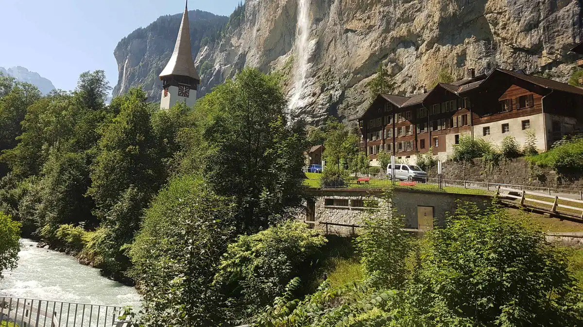
An hour in Lauterbrunnen village then three hours loose in car-free Mürren, all by public rail and cable car with a small group. Trümmelbach Falls sits on the route but its entry fee is paid separately at the gate if you stop there.
Check AvailabilityPrices, ratings and details are the platform's own. Dollar figures are the listed prices. The platform bills in your account's currency.
Picking A Trail For The Time And Legs You Have
We route these six trails by clock time rather than by any ranking, because this site does not rank trails. The honest starting point is that only two of the six carry a published time, so the groupings below lean on the nature of each route and its lift access. Match the route to the day you actually have, not the day you wish you had.
- Under an hour: the first stretch of the valley floor walk out of Lauterbrunnen, up to and including the Trümmelbach turnoff at about 3 km, then the postbus back.
- Half a day: the Sulwald-Lobhornhütte trail, with its published 2 hours and 4.8 km, plus the cable car rides up and down from Isenfluh.
- A full day, moderate: the North Face Trail above Mürren, reached by cableway or railway, with time in Mürren and Gimmelwald built in.
- A full day, via ferrata: the Mürren-Gimmelwald via ferrata in the morning after gear rental, since its roughly 400 m of height and exposed sections should not be rushed, followed by an easy valley floor stroll to recover.
Two honest caveats. First, where a route has no official published length, such as the valley floor walk, the North Face Trail or the Stechelberg to Oberhornsee walk, treat any time estimate you find elsewhere as unofficial, including any you might mentally attach to this page. Second, lift opening hours shape the day more than the walking does.
The Isenfluh-Sulwald cable car runs first at 07:00 and last at 18:15, and it closes entirely for a few days each autumn and spring for maintenance, in early November and late April into early May. The via ferrata only exists between 1 June and 31 October at all. Check those windows before you fix a plan.
Weather, Gear And Via Ferrata Safety
Most of the routes on this page are ordinary marked paths, and for them normal mountain sense is enough: check the forecast, carry a layer, and turn back if the sky over the Eiger turns black. The via ferrata is a different category and has its own published rules, which come from Lauterbrunnen Tourism directly. Go out only in good weather, and leave the route immediately if conditions turn or if a thunderstorm puts the exposed sections at risk.
Keep one carabiner clipped to the safety cable at all times, which is the single habit that keeps a slip from becoming a fall. The minimum kit is a via ferrata set, a helmet, a harness and sturdy footwear, and all of it can be rented from sports shops in the area, so you do not need to own any of it for one day on the route. If you are an inexperienced climber, the advice is to go with a mountain guide rather than attempt the route alone.
Remember the entry rules too: a minimum height of 1.50 m and a weight between 40 kg and 100 kg, and a season from 1 June to 31 October only. The 90 m Nepal suspension bridge over the Mürrenbach gorge is exposed to wind and is not the place to test whether the weather is really as bad as it looks.
The Lift Each Trail Needs First
Every trail here is free to walk, but several need a lift ride to reach the start. Fares and timetables change, so price the lift leg on its own page before you set out.
The table below sets each trail against the one lift it needs first, and where to check that lift's current fare rather than trust a number printed here.
| Trail | Lift Needed First | Where To Price It |
|---|---|---|
| Valley floor walk | None | Free at any time |
| North Face Trail | Mürren cableway or railway | Getting around Lauterbrunnen |
| Mürren-Gimmelwald via ferrata | None from the Mürren end, the cableway from the valley, or walk down to Gimmelwald | Lauterbrunnen to Mürren |
| Isenfluh-Sulwald and connectors | Isenfluh-Sulwald cable car, US$12.15 (CHF 10.00) single | Isenfluh guide |
| Stechelberg to Oberhornsee | None from Stechelberg itself | Stechelberg guide |
Which Season Actually Changes What You Can Walk
Season decides more on this page than distance does, because two of the six trails simply do not exist outside a fixed window. The Mürren-Gimmelwald via ferrata runs only from 1 June to 31 October. Outside those five months the steel cables, the rungs and the 90 m Nepal suspension bridge are still bolted to the rock, but the route is not maintained or signed as open, and Lauterbrunnen Tourism's own guidance assumes a summer window when it lists the entry rules. Book a via ferrata day only inside that stretch, and treat late May or early November as a gap even if the weather looks fine from the valley floor.
The Isenfluh-Sulwald cable car runs all year, but it closes completely for two short maintenance windows: the autumn revision and a longer spring revision, both a matter of days rather than weeks, with a couple of weekend departures kept running during the spring closure. Neither window is long, but either one can strand a trip built entirely around a Sulwald day, so check the current dates on our Isenfluh page before committing a specific date to the Sulwald-Lobhornhütte trail.
The valley floor walk, the North Face Trail and the Stechelberg to Oberhornsee walk carry no seasonal shutdown of their own, since none of them depends on a single piece of machinery to open. What changes for these three is simply what the ground looks like. Snow at altitude lingers longer on the North Face Trail and the approach to Oberhornsee than it does on the flat valley floor, since both sit higher and face terrain that holds snow into late spring. None of this page states exact snowline dates, because no official source publishes one for these specific paths, and guessing a date would be worse than saying nothing. The practical rule is the one every trail on this page shares: check current conditions before a high-altitude walk in shoulder season, and default to the valley floor walk when in doubt, since it is the one route on this list that asks nothing of the calendar.
Every Trail On One Map
One map, all six numbered trails. Dark pins need no lift, brown pins need a cableway, railway or cable car before the walking starts.
Coordinates approximate, from OpenStreetMap and the operators' own trail pages.
Guided Or Alone, Trail By Trail
Most of the six routes on this page are walked without a guide, and nothing here requires one by rule. The valley floor walk, the North Face Trail and the Sulwald-Lobhornhütte trail are all ordinary marked paths where sure footing and a weather check are enough. The one exception is the Mürren-Gimmelwald via ferrata, and it is an exception for a stated reason rather than a marketing one: Lauterbrunnen Tourism's own guidance recommends that inexperienced climbers go with a mountain guide, given the exposed sections and the 90 m suspension bridge over the Mürrenbach gorge. That advice sits alongside the hard entry rules on height and weight, and together they tell you this is the one route on the page where local judgment says a guide is the safer default rather than an optional upgrade.
Almost no tour sold for this valley is a guided hike in the way a mountain-town visitor might expect. The tours that exist here are built around lift tickets, minibus transfers and flights off a ledge, which is why the Lauterbrunnen-Mürren small group day from Interlaken is the closest match: it puts you in Mürren and Gimmelwald with time to explore on foot, rather than a route march with a hired guide leading the way. If you specifically want a guided via ferrata day, ask locally in Mürren or Gimmelwald once you arrive, since no product in our own tour list covers it directly. For every other trail here, a paper map or a phone with the relevant page open is the practical minimum, and the operators' own trail markers do the rest.
Plan The Rest Of The Day Around A Trail
Each trail pairs naturally with a village, a falls stop or a transport plan. These guides fill in the hours either side of the walk.
Stechelberg
The gateway to the Oberhornsee walk and the valley floor walk's quiet end, with the Schilthorn cableway valley station and postbus links back down the valley.
Isenfluh
The village at the foot of the Sulwald cable car, with the 14-minute postbus ride from Lauterbrunnen, closure dates and eating options on the mountain.
Getting Around Lauterbrunnen
Trains, cableways and postbuses, including the Mürren cableway and railway you need for the North Face Trail and the via ferrata.
Lauterbrunnen Hikes Questions
How long is the valley floor walk from Lauterbrunnen to Stechelberg?
No official length or walking time is published for the route. The only published figure is the Trümmelbach Falls turnoff, about 3 km from Lauterbrunnen station.
Is the Mürren-Gimmelwald via ferrata free?
The route itself is free to use, with gear rental from sports shops costing extra. You must be at least 1.50 m tall and weigh between 40 kg and 100 kg, and it is open from 1 June to 31 October only.
How much does the Isenfluh-Sulwald cable car cost?
An adult single costs US$12.15 (CHF 10.00) and a return US$19.44 (CHF 16.00). It runs every 15 minutes from 07:00 to 18:15, closing for a few days each autumn and spring for maintenance.
Which Lauterbrunnen hike has a published distance and time?
The Sulwald-Lobhornhütte trail: 2 hours, 4.8 km, with about 170 m of ascent and 170 m of descent from the Sulwald cable car top station.
Is the Stechelberg to Oberhornsee walk inside a World Heritage Site?
Yes. It runs through woodland and alpine terrain to a mountain lake inside the Swiss Alps Jungfrau-Aletsch UNESCO World Heritage Site, inscribed in 2001, with views of the Grosshorn and Mittaghorn north faces. No official length is published for it.
Do I need a guide for any of these hikes?
Not by rule, except that Lauterbrunnen Tourism's own guidance recommends a mountain guide for inexperienced climbers on the Mürren-Gimmelwald via ferrata, given its exposed sections and the 90 m suspension bridge. The other trails on this page are ordinary marked paths, walked without a guide by most visitors. See guided or alone, trail by trail.
Lauterbrunnen Hikes On Film
Three videos covering trails in and above the valley.
7 Easy Hikes in the Jungfrau Region | Hiking in Switzerland | Interlaken, Lauterbrunnen, Grindelwald
A survey of easier trails in the wider region, including the Lauterbrunnen side.
Video: Aplins in the AlpsSWITZERLAND: 1 Week Hiking above Lauterbrunnen
A longer look at multiple days of hiking above the valley.
Video: Karl Watson: Travel DocumentariesSwitzerland: The Best Hikes Near Interlaken (Lauterbrunnen, Grindelwald, Murren)
A rundown of trails across the valleys around Lauterbrunnen.
Video: RyanTravelsPrices, hours and terms are set by the venue or operator and confirmed at checkout.
We may earn a commission if you book through one of our links, at no extra cost to you. Full affiliate disclosure