 Lauterbrunnen City Guide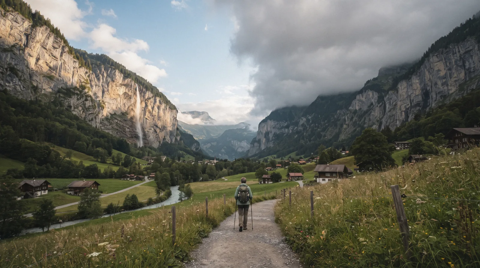
Lauterbrunnen Weather: The Valley Floor and the Summits Are Different Climates
Lauterbrunnen runs two climates at once. The valley floor sits at 799 m in our climate data, where July afternoons average 22.0C. The Jungfraujoch weather station sits at 3,580 m, and its annual mean temperature is -6.7C. A clear morning in the village says nothing about what is happening above the cliffs, and most visitors only find that out at the top of a cableway. This Lauterbrunnen weather page gives you the real numbers for both levels, month by month, so you can read the sky before you spend money. For what the trips cost, see what Lauterbrunnen costs. For the wider trip, start with our Lauterbrunnen Switzerland guide.
Quick answer Lauterbrunnen weather in one paragraph
The valley floor averages 22.0C in July and drops to 3.5C in January, but the Jungfraujoch at 3,580 m never gets warmer than 0.6C on average, even in August.
Key takeaways
- July is both the warmest and the wettest month in the valley, with 22.0C highs and 214 mm of rain. See the full month table below, and our best time to visit Lauterbrunnen page for how that shapes a trip.
- The summit climate is a different world. The Jungfraujoch station's annual mean is -6.7C and its record low is -35.4C.
- Plan around rain, not around cold. May to August each bring 209 to 214 mm, so keep our rainy day in Lauterbrunnen list handy.
- Summit tickets are weather bets. Compare the Jungfraujoch ticket and Schilthorn ticket pages before you commit.
The Valley Floor by Month
These figures come from the ERA5 reanalysis for 1995 to 2024, taken at a grid cell whose model elevation is 799 m, essentially the Lauterbrunnen valley floor. They are thirty-year averages, not forecasts, so any given day can sit well outside them.
July is both the warmest month (22.0C) and the wettest (214 mm), while February is the driest at 109 mm, a pattern that matters more than the temperature itself, as our best time to visit Lauterbrunnen page explains.
How Much It Rains, and When
This table compares average monthly precipitation in millimetres with the average number of days recording measurable precipitation, both computed from the ERA5 reanalysis for the valley floor, 1995 to 2024. It answers a simple question: how often will rain shape your day?
| Month | Precipitation | Rainy Days |
|---|---|---|
| January | 125 mm | 14.0 |
| February | 109 mm | 12.7 |
| March | 122 mm | 14.8 |
| April | 135 mm | 15.2 |
| May | 213 mm | 20.0 |
| June | 211 mm | 19.5 |
| July | 214 mm | 19.2 |
| August | 209 mm | 17.7 |
| September | 156 mm | 15.4 |
| October | 127 mm | 13.0 |
| November | 133 mm | 14.0 |
| December | 134 mm | not separately in our data |
May to August average 17.7 to 20.0 rainy days per month, which is roughly two days out of three, so build a rainy day in Lauterbrunnen plan before you travel.
The Valley Floor Is Not the Summit
One valley, two climates separated by about 2,655 vertical metres. Here is what the data says about each level.
What 799 Metres Feels Like
The valley floor has a temperate Alpine climate with real summer and real winter. Average daily highs climb from 3.5C in January to 22.0C in July, then fall back to 4.5C by December. Nights below freezing are normal from November to March, with January averaging -3.9C as the daily low.
Rain falls all year, and the summer months are the wettest, driven by snowmelt in May and thunderstorms in June through August. Even the driest month, February, records 109 mm. In practice that means you should pack a rain layer in any month, and expect the valley's famous Staubbach Falls, which drop 297 m, to be at full volume in the melt season and reduced to an icy trickle in deep winter.
These averages describe the village level where you sleep and eat, not the summits you ride up to.
What 3,454 Metres Feels Like
The MeteoSwiss climate normals for the Jungfraujoch station (JUN, WMO 06730) sit at 3,580 m and cover 1991 to 2020, with extremes recorded since 1973. The annual mean temperature there is -6.7C. The annual average daily high is only -3.8C and the annual average daily low is -9.4C.
Monthly means run from -13.3C in February, the coldest, to 0.6C in August, the warmest, with July close behind at 0.4C. In other words, even at the peak of summer the Jungfraujoch just touches above freezing on average, while the valley floor 2,655 m below averages 21 to 22C in the same months. The all-time record high since 1973 is 14.3C, measured in July.
The all-time record low is -35.4C, measured in February. Mean relative humidity runs at 70 percent across the year, and annual sunshine totals 1,773.2 hours. None of this makes the Jungfraujoch a bad trip.
The train runs in fog and snow through a tunnel in the Eiger and Mönch, and the ice palace and observation building work in any weather. But it does mean you dress for a summit, not for the valley you left an hour earlier. Check current Jungfraujoch tickets and read the mountain forecast before you go.
The Schilthorn Sits Between
The Schilthorn summit stands at 2,970 m, roughly 2,170 m above the valley floor, between the two extremes on this page. No separate official temperature normal is published for the Schilthorn itself, so we will not invent one. What matters practically is exposure.
A cliff-face walk at 2,970 m closes to wind and ice well before the valley below notices the weather has turned, and cloud can cut visibility to nothing on a day when Lauterbrunnen village sits in sunshine. The Birg Thrill Walk and the summit terrace are the parts most exposed to that. Treat a warm valley forecast as necessary but not sufficient before riding up, and check the operator's live webcams on the morning itself.
What the Weather Decides
Weather in this valley is not small talk. It sets which lifts run, which attractions are open, and how far your ticket money goes.
The Lift Days
A clear morning in the village is not proof of a clear summit. Cloud often fills the high ground while the valley floor stays blue, and the reverse happens too. That gap is exactly why Jungfraubahnen strongly recommends a US$12.15 (CHF 10) seat reservation on the Jungfraujoch railway in good weather, and why its Good Morning fare, with 20 percent off the first two connections of the day, runs 1 May to 31 October 2026.
Both only pay off if you have actually looked at the mountain forecast and webcams before committing. The same logic applies to the Schilthorn ticket: the cableway runs in most weather, but a whiteout summit gives you a restaurant and an exhibition, not a view. Check the sky first, then buy.
The Season Switches
Some attractions simply shut when the weather turns. Trümmelbach Falls, the ten glacier waterfalls inside the mountain, open daily from the beginning of April to the beginning of November, 09:00 to 17:00, extended to 08:30 to 18:00 in July and August. Outside that window the falls run as a trickle under ice, so a winter visit is a different experience entirely.
Lift maintenance also follows the seasons. The Stechelberg to Mürren cableway closes 19 to 30 October 2026, with a shuttle bus via Mürren running 08:00 to 18:00 and limited seats, and again 26 April to 7 May 2027. The Mürren-Allmendhubel funicular closes 19 October to 11 December 2026.
Check our getting around Lauterbrunnen page and the Allmendhubel details before booking anything in those windows.
Weather-Proof and Weather-Dependent Bookings
A summit ticket is a bet on the sky, since the train may run while the view does not. The valley floor tours below run in any weather the valley itself throws at them.
 from $315.00
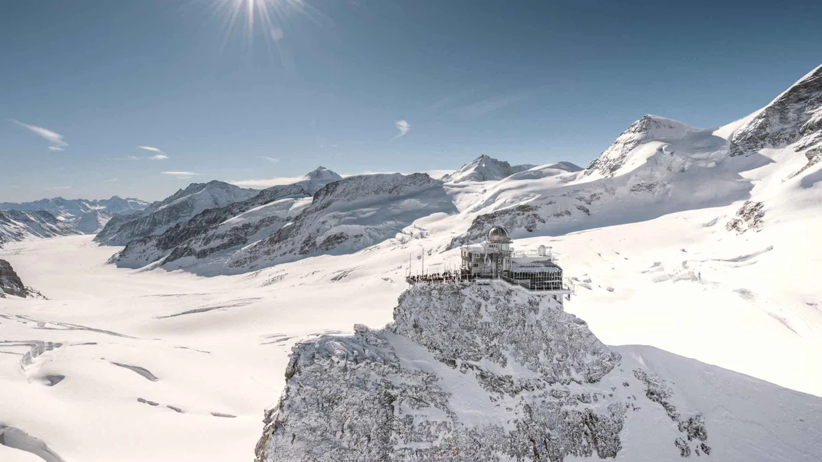
From Lauterbrunnen: Ticket to Jungfraujoch - Top of Europe
This is a train ticket, not a guided tour: you board at Lauterbrunnen and ride yourself to Jungfraujoch's ice palace and observation deck. Late arrivals still travel but lose the reserved seat on the Kleine Scheidegg to Jungfraujoch leg.
Check Availability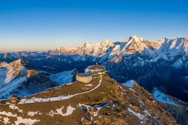 from $73.32
Schilthorn - Piz Gloria Ticket
This is the operator's own Stechelberg-Schilthorn return ticket sold through Viator, with the Bond World exhibit and Thrill Walk folded in, not a separate tour. Ascents run every hour at xx:25 and xx:55, so time your arrival at the valley station around that clock.
Check Availability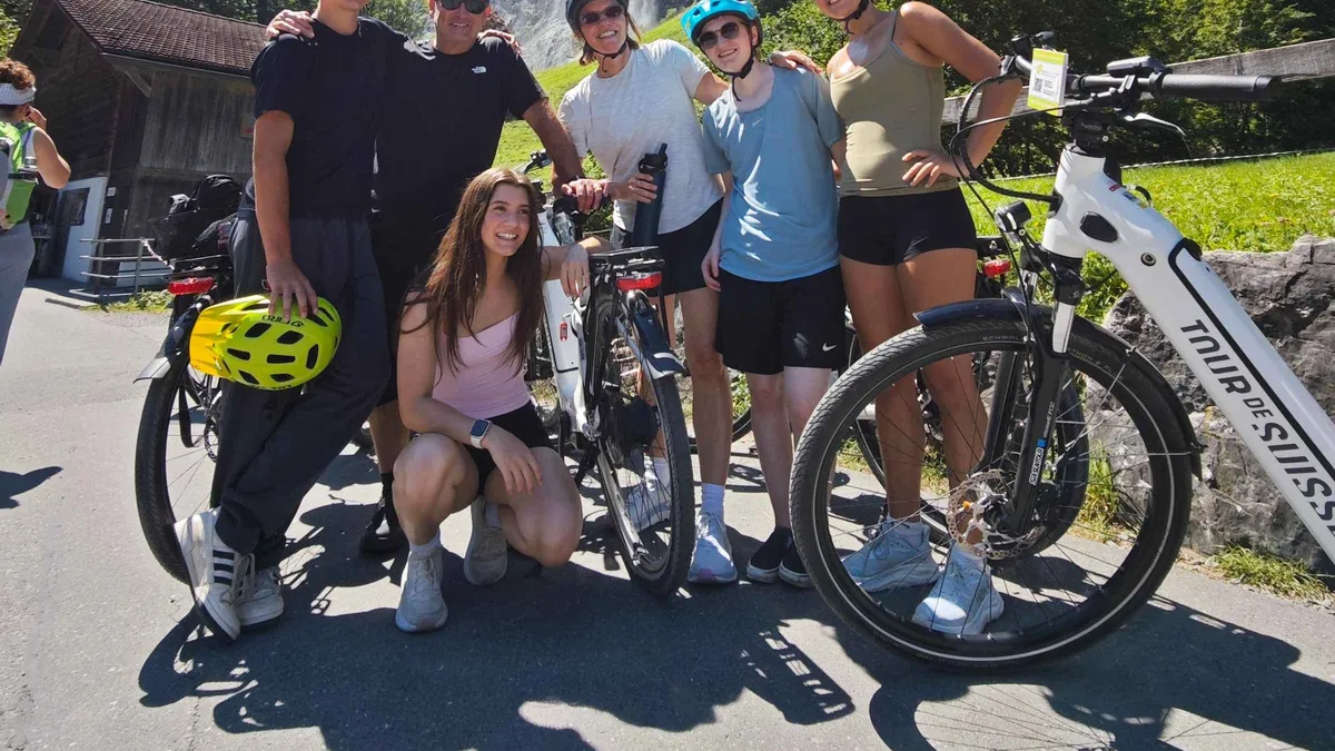 from $302.00
Interlaken: 72 Waterfalls Valley & Lauterbrunnen E-Bike Tour
A guided e-bike loop from Interlaken along the river into the valley, with the Trümmelbach Falls entry fee already folded into the price. Riders who cannot handle a bicycle are turned away at the start, so this is not a beginner's first ride.
Check Availability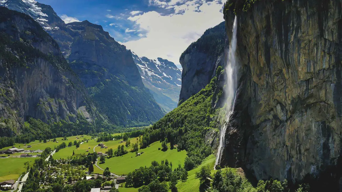 from $254.00
Interlaken: Lauterbrunnen + Trümmelbach Falls Tour
A door-to-door minibus with an English-speaking host instead of a fixed meeting point, built around an easy walk rather than a hike. The Trümmelbach Falls entry fee is not folded into the price, it is paid at the gate.
Check AvailabilityCard prices are the platforms' own listed US-dollar figures.
Prices, ratings and details are the platform's own. Dollar figures are the listed prices. The platform bills in your account's currency.
Lauterbrunnen Weather Questions
What is the best month for weather in Lauterbrunnen?
That depends on what you want from the weather. The warmest valley months are July and August at 22.0C and 21.9C average highs, but they are also the wettest, with 214 mm and 209 mm and around 19 rainy days each. September offers 18.1C with rainfall down to 156 mm. February is the coldest on the valley floor but the driest month at 109 mm. We compare the trade-offs on our best time to visit Lauterbrunnen page rather than picking one winner here, and the wider Lauterbrunnen valley picture sits on our home page.
Is it cold in Lauterbrunnen?
At the valley floor, only in the colder months. January averages a high of 3.5C (38°F) and a low of -3.9C, and December and February sit close to that. In July the average high is 22.0C. The cold question changes completely with altitude. The Jungfraujoch station's annual mean temperature is -6.7C, and its warmest month, August, averages just 0.6C. Visitors often feel both climates on the same day.
Does it rain a lot in Lauterbrunnen?
Yes, by most standards, and it falls year round. The wettest month is July at 214 mm, followed by May at 213 mm and June at 211 mm. May also averages 20.0 rainy days, the most of any month. The driest month is February at 109 mm, still more than many lowland cities see in a wet month. Even in the driest stretch, September and October, monthly rainfall runs 156 mm and 127 mm, so a rain layer belongs in your bag in every season.
Is the weather different on the Schilthorn or Jungfraujoch?
Dramatically. The MeteoSwiss climate normals for the Jungfraujoch station at 3,580 m give an annual mean of -6.7C, with monthly means from -13.3C in February to 0.6C in August, and a record low of -35.4C. The valley floor 2,655 m below averages 21 to 22C in July and August. No separate official normal is published for the Schilthorn at 2,970 m, but at roughly 2,170 m above the village it sits closer to the summit climate than to the valley one, and its exposed cliff-face walk closes to wind and ice before the valley notices a change.
Can I check the weather before I go up?
Yes, and you should before buying any summit ticket. Both operators run live webcams from their stations, so look at the Schilthorn and Jungfraujoch camera views on the operator's own sites on the morning of your trip, alongside a mountain forecast for the Jungfrau Region. Remember that a clear webcam in the morning can still mean cloud by afternoon, which is why Jungfraubahnen only strongly recommends, not mandates, the CHF 10 seat reservation in good weather. If the view is doubtful, the valley floor attractions and our rainy day list cost far less than a summit ticket on a whiteout.
The Valley in Different Weather
Three views of Lauterbrunnen in contrasting conditions, filmed at street level.
Lauterbrunnen 4K Rainy - Switzerland
The village and valley floor during a wet day, the kind that hits the valley 17 to 20 days a month from May to August.
Video: YouTubeRain & Thunder Sounds in Lauterbrunnen Switzerland
A summer thunderstorm over the valley, the pattern behind July's 214 mm average.
Video: YouTubeLauterbrunnen Switzerland: Walking in the Rain
A walk along the valley floor in low cloud, while the summits above stay out of sight.
Video: YouTubeWe may earn a commission if you book through one of our links, at no extra cost to you. Full affiliate disclosure