 Lauterbrunnen City Guide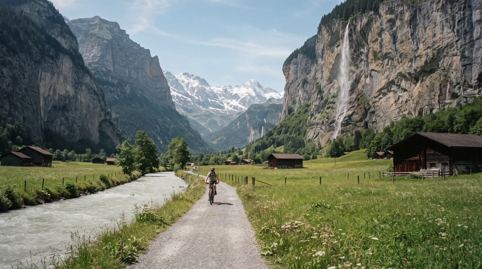
Lauterbrunnen Waterfalls: The Valley Floor And The Count of 72
Lauterbrunnen waterfalls are counted at 72 by the valley's own tourism boards, but only two carry a name, a path and a reason to visit: Staubbach Falls and Trümmelbach Falls. This page explains what the count actually means and covers the free, flat valley floor walk that shows most of them at once. Plan the rest of a first trip on visit Lauterbrunnen.
Quick answer The short version on the 72 waterfalls and the valley floor
Lauterbrunnen is promoted as the valley of 72 waterfalls. The count comes from the Jungfrau Region and Lauterbrunnen tourism boards, not from a survey, and no numbered map of the falls exists. Only two are named, signposted attractions you can enter. Staubbach Falls drops 297 metres in the village and viewing it is free. Trümmelbach Falls, about 3 km up the valley, carries ten falls inside the mountain and charges US$21.90 (CHF 18) for an adult. The other roughly 70 are unnamed seasonal streaks on the cliff walls with no path or viewpoint. The valley floor between the village and Stechelberg is flat, open to walkers at all times and free.
Key takeaways
- 72 is a standard tourism count, no official list or map of the individual falls is published
- Only Staubbach Falls and Trümmelbach Falls can be visited as named attractions, our guides cover each in full
- The valley floor walk is free and open 24 hours, but no official distance or walking time is published beyond the Trümmelbach turnoff at about 3 km
Key facts
Opening hours
| Valley floor and view of the falls | Open–24 hours, year-round |
|---|
Closed Never. Trümmelbach Falls, the one ticketed stop, closes Nov-April
Admission
- Adult
- Free to walk the valley floor and view the falls from outside
- Reduced
- Trümmelbach Falls entry: US$21.90 (CHF 18) adult, US$9.72 (CHF 8) child 6-15
- Free
- The valley floor, Staubbach Falls and every unnamed fall
Planning it
- Time needed
- Not stated officially. Our estimate: 1-2 hours one way
- Address
- Valley floor road and path between Lauterbrunnen village and Stechelberg
There is no gate, ticket or booking for the waterfall valley itself. You arrive, you walk, you look up. The table below sets out every way money can enter the picture, from the free unguided walk to the two paid options, so you can decide what, if anything, is worth paying for.
Most people need nothing at all. The valley floor is free, so you only pay if you enter Trümmelbach Falls or join a tour.
| Option | Price | Covers | Cancel | Book |
|---|---|---|---|---|
| Walk the valley floor, unguidedAnyone on foot who wants the waterfall valley at zero cost and on their own clock | Free | The flat path and road between Lauterbrunnen village and Stechelberg, views of Staubbach Falls and every cliff-wall streak | Not applicable | Official site |
| Trümmelbach Falls entryVisitors who want to stand inside the waterfalls rather than look at them from the valley floor | US$21.90 (CHF 18) adult | The ten glacial falls inside the mountain, reached through tunnels and lifts about 3 km up the valley | Not stated as refundable | Official site |
| Guided e-bike tour from InterlakenConfident cyclists who want the full length of the valley covered quickly with a guide and one paid entry folded in | $302.00 as listed | A guided ride along the whole valley floor with the Trümmelbach Falls entry fee included | 24 hours before the start time | Check Availability |
Figures current in Q3 2026.
The One Guided Way To Cover The Whole Floor
One guided option covers the ground this page describes. The Interlaken: 72 Waterfalls Valley & Lauterbrunnen E-Bike Tour rides the length of the valley floor on an e-bike, stops at both named falls and includes the Trümmelbach Falls entry fee in the price.
 from $302.00
Interlaken: 72 Waterfalls Valley & Lauterbrunnen E-Bike Tour
A guided e-bike loop from Interlaken along the river into the valley, with the Trümmelbach Falls entry fee already folded into the price. Riders who cannot handle a bicycle are turned away at the start, so this is not a beginner's first ride.
Check AvailabilityPrices, ratings and details are the platform's own. Dollar figures are the listed prices. The platform bills in your account's currency.
What The Count Of 72 Actually Means
Start with honesty, because this is a number that gets repeated more often than it gets explained. The claim that Lauterbrunnen holds 72 waterfalls is the standard figure used by the Jungfrau Region and Lauterbrunnen tourism boards themselves. It is not the result of a hydrological survey. No numbered map exists, no official list names the 72 falls one by one, and no signpost in the valley points to fall number 41. If you try to count them from the valley floor you will get a different total depending on the season, because most of them are seasonal. In snowmelt and after rain the cliff walls carry dozens of thin white streaks. In a dry late summer week many of those same streaks shrink to a damp line or disappear altogether.
The number is old, though, and it is not marketing invented last decade. The valley's name was first documented in 1240 as 'in claro fonte', and the village name itself is usually traced to 'lauter Brunnen', meaning many springs, or to 'lautere Bäche', meaning clear streams. Either way, the people who named this place a thousand years ago were describing the same thing the tourism boards describe today. Water comes off the valley walls from everywhere. The glacial rivers feeding the big falls drain the Eiger, Mönch and Jungfrau, and the porous cliffs weep from a hundred small sources.
So treat 72 as a description of character rather than an inventory. It tells you that wherever you stand on the valley floor you will see falling water somewhere on the walls above you. It does not promise 72 destinations. Two of the falls are developed, named and visitable, and they get their own pages on this site. The rest are scenery, and scenery is exactly what they should be. Anyone selling you a list of all 72 is improvising, because no such official list exists.
The Two You Can Actually Visit
Of the famous count, exactly two waterfalls have names you will find on signs, paths built for visitors and, in one case, a ticket window. Everything else in the valley is backdrop. These two are covered in depth on their own pages, so the summaries below only set the scene and tell you which page to read next.
Staubbach Falls, Free, In The Village
You do not have to go anywhere to see the first of the two. Staubbach Falls pours 297 metres down the cliff directly behind Lauterbrunnen village, and Jungfrau Region Tourism describes it as the highest free-falling waterfall in Switzerland. Viewing it from the valley floor costs nothing and needs no planning, it is simply there, above the church and the rooftops.
A paved path leads from the village street directly to the base, with no gate and no fee at any point. Conditions and access are described in full in our Staubbach Falls guide. For the purposes of this page, note only that it is the named exception that proves the rule.
The other 70-odd falls have no path, no name on a sign and no entrance.
Trümmelbach Falls, Paid, Up The Valley
The second named attraction is different in every way. The Trümmelbach Falls are ten glacial falls hidden inside the mountain itself, draining a catchment of 24 square kilometres on the Eiger, Mönch and Jungfrau, and you reach them through tunnels and lifts. They sit about 3 km up the valley from Lauterbrunnen station, and they charge US$21.90 (CHF 18) for an adult and US$9.72 (CHF 8) for a child aged 6 to 15.
They close completely from November to the beginning of April, when the water drops to a trickle under ice. Children under 4 and dogs are not admitted. Opening hours, the postbus connection and what the visit feels like are covered in our Trümmelbach Falls guide.
If you only pay for one waterfall thing in this valley, this is the one with something behind the paywall.
Walking The Valley Floor
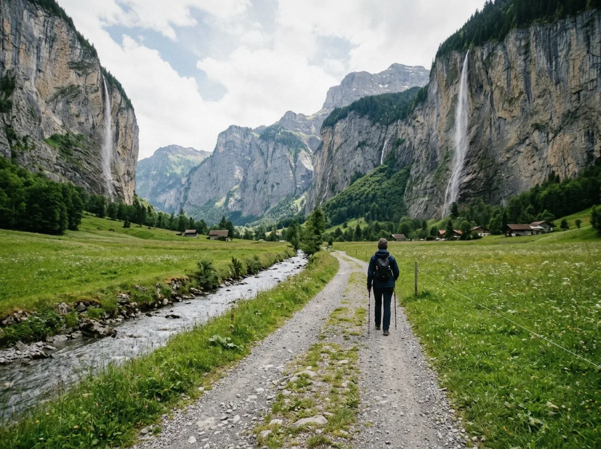
The valley floor path between the cliff walls.
Here is the part most visitors actually do, and the part this page can describe honestly. Between Lauterbrunnen village and Stechelberg at the far end of the valley there is a flat valley floor, threaded by a quiet road and paths, and it is free to walk at all times of day and all times of year. There is no ticket office, no opening hour and no gate. You step out of the station, Lauterbrunnen train station sits right in the village, and you walk up the valley with the cliff walls on both sides.
Now the honest caveat. No official distance or walking time is published for the full village-to-Stechelberg walk. We will not invent one. The only official figure on record is that the Trümmelbach Falls turnoff lies about 3 km from the station, which gives you a fixed checkpoint early in the walk. Beyond that, how long the full stretch takes you depends on your pace, how many times you stop to look up, and whether you carry on past Stechelberg. Our own rough planning estimate, clearly labelled as ours and not an official figure, is 1 to 2 hours one way. Treat it as an order of magnitude, nothing more.
The surface is flat the whole way, which makes it one of the easiest walks in the area and suitable for almost anyone. If two hours on foot sounds like too much, or you want the whole valley covered with a guide, the e-bike option solves it. The Interlaken: 72 Waterfalls Valley & Lauterbrunnen E-Bike Tour rides the length of the valley floor on electric bikes, stops at both named falls and folds the Trümmelbach entry fee into the price. A postbus also runs up the valley if you want to walk one way and ride back.
What Else The Cliffs Show You
The unnamed falls deserve a proper description, because they are most of the 72. They have no names you can look up, no paths leading to them and no viewpoints built for them. They are thin seasonal streams that leap off the valley walls hundreds of metres above you, lose their shape in the wind and land as mist or as a faint trace on the rock. Some carry water year-round, most do not. Snowmelt in spring and early summer is when the walls are at their busiest, which is worth factoring into when you come, as our best time to visit page explains.
The walk's far end gives the valley a second act. Stechelberg is a small village at the base of the Schwarzmönch, and it is where most people turn around. You do not have to. From Stechelberg the route continues toward the Oberhornsee, a mountain lake, through woodland and then alpine terrain, with views of the north faces of the Grosshorn and Mittaghorn. This upper section climbs out of the flat valley floor and needs more planning than the walk described above, so read the hiking page before committing.
There is a heavier reason to care about this ground too. The upper valley lies inside the Swiss Alps Jungfrau-Aletsch site, inscribed as a UNESCO World Heritage Site in 2001. The waterfall valley you walked through for free is the front door to one of the most protected mountain landscapes in the Alps. That status does not change what you see from the path, but it explains why the walls stay wild and why the unnamed falls were never developed. Nobody is going to build a staircase to fall number 53, and the valley is better for it.
Map Of The Valley
Four markers cover everything this page names. The two falls in blue are the only named, visitable ones. The brown markers are the start and end of the valley floor walk. Note that only the two falls and these endpoints are pinned, because the other 70-odd waterfalls have no mapped locations.
Coordinates from Wikidata and OpenStreetMap.
The Named Falls And What Sits Beyond Them
Everything on this page connects to a handful of places worth their own read. Start with the two falls, then look at what waits at the end of the walk.
Staubbach Falls
The village fall, 297 metres and free to view, with a summer ledge that puts you behind the water.
Trümmelbach Falls
The paid attraction, ten glacial falls inside the mountain, closed from November to the beginning of April.
Stechelberg
The quiet village at the far end of the valley floor, and the jumping-off point for the Schilthorn cableway and the upper valley.
Lauterbrunnen Waterfalls Questions
Are there really 72 waterfalls in Lauterbrunnen?
It is the standard figure used by the Jungfrau Region and Lauterbrunnen tourism boards, and the valley's very name, documented in 1240, refers to its many springs and clear streams. But it is not a survey and no numbered map of the falls exists. Expect a different count depending on season, since most of the falls are thin seasonal streaks.
Can you visit all 72 waterfalls?
No. Only two are named, signposted attractions with access built for visitors. Staubbach Falls in the village is free, and Trümmelbach Falls about 3 km up the valley charges entry. The rest have no paths, no viewpoints and in many cases no water outside the melt season.
How long is the walk from Lauterbrunnen to Stechelberg?
No official distance or walking time is published for the full walk, so we will not give you a fake number. The only official figure is that the Trümmelbach turnoff sits about 3 km from the station. Our own rough estimate for the full one-way stretch is 1 to 2 hours on the flat.
How much does it cost to see the Lauterbrunnen waterfalls?
The valley floor and the view of Staubbach Falls are free, at any hour, year-round. The only fee in the valley is Trümmelbach Falls, at US$21.90 (CHF 18) for an adult and US$9.72 (CHF 8) for a child aged 6 to 15. A guided e-bike tour covering the valley with that entry included lists at $302.00.
When do the waterfalls have the most water?
In the melt season, when snow and ice on the Eiger, Mönch and Jungfrau feed the streams. That is when the unnamed cliff streaks flow hardest. Trümmelbach Falls itself drops to a trickle under ice from December to March and closes to visitors from November until the beginning of April.
Where The Valley Floor Fits In A Day
The valley floor walk is the spine of any first visit to Lauterbrunnen, and it pairs naturally with the two named falls. A straightforward day looks like this. Arrive by train, spend the first half hour at Staubbach Falls at the foot of the village since it costs nothing, then set off up the valley floor. At about 3 km you reach the Trümmelbach turnoff, which is the natural point to go in if you are paying for one attraction, or to press on if you are not. Beyond it the walls quiet down and the valley narrows toward Stechelberg, where the postbus can carry you back if your legs are done.
If you would rather not plan any of it, or you want the distance covered for you, the Interlaken: 72 Waterfalls Valley & Lauterbrunnen E-Bike Tour does the whole floor on e-bikes in a guided six-hour day with the Trümmelbach entry already paid. For a fuller plan that bolts the village, both falls and the walk together into one route, our one day in Lauterbrunnen itinerary lays it out hour by hour. And once you have seen the two named falls up close, the rest of the 72 will make sense. They were never meant to be ticked off. They are the reason the valley floor is worth walking at all.
The Valley Floor On Film
Three views of the valley and its waterfall count, from the ground and from the air.
A Guide To Lauterbrunnen Valley | Switzerland | The Valley of 72 Waterfalls
An overview of the valley and where the 72-waterfall count comes from.
Video: traveldotearthLauterbrunnen, Switzerland 4K walk - Valley of 72 Waterfalls
A walking-pace view of the valley floor and its cliffs.
Video: Duslin Travels72 Waterfalls in One Valley | Lauterbrunnen Switzerland
A shorter survey of the falls along the valley walls.
Video: Swiss TravelerPrices, hours and terms are set by the venue or operator and confirmed at checkout.
We may earn a commission if you book through one of our links, at no extra cost to you. Full affiliate disclosure